AUTONOMOUS FIELD INTELLIGENCE

AI that can move, observe and understand the physical world.

SpatialXplor combines autonomous robotics, sensing, edge AI and spatial intelligence to help experts inspect, understand and act on real-world environments.

Autonomous survey mission · No manual control · Field-to-cloud intelligence

01 02 03
Physical world → spatial intelligence Observe · locate · interpret · review

THE PLATFORM

A common intelligence layer for different field environments.

SpatialXplor is not tied to one industry, robot or sensor. The platform connects autonomous machines with the sensing and AI required by each domain problem.

01MobilityNavigate the environment
02SensingObserve physical conditions
03Edge AIInterpret locally
04Spatial contextKnow where it happened
05Expert reviewTurn evidence into decisions

Designed for the field

Local sensing, processing and storage allow missions to continue when connectivity is unavailable.

Robot and sensor extensible

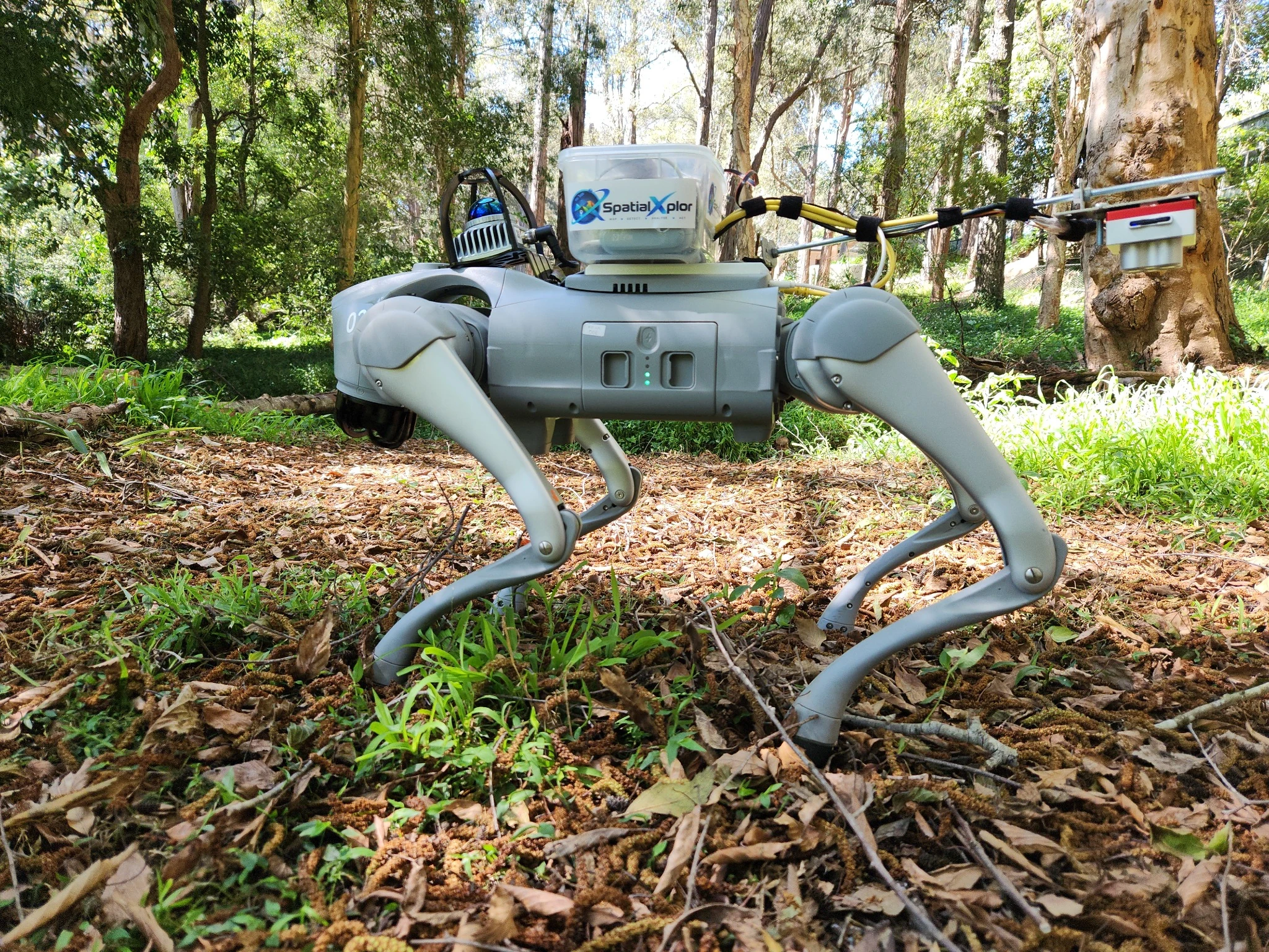
The current prototype uses a quadruped robot, LiDAR and five-band multispectral imaging, but the architecture is not tied to that hardware.

Secure field-to-cloud architecture

SpatialXplor builds on secure multi-tenant cloud technology that has previously undergone independent penetration testing as part of an earlier commercial deployment.

Expert in the loop

The objective is to extend specialist observational reach, not replace expert judgement.

APPLICATIONS

One architecture. Three very different environments.

The common problem is physical observation at scale. The sensing, AI and operating model change according to what the domain expert needs to know.

01 / RESOURCES

Mineral exploration

Autonomous close-range geological observation and spatially referenced evidence for geologist review.

  • Multispectral and geological sensing
  • AI-assisted material screening
  • GPS-denied spatial context

02 / INFRASTRUCTURE

Infrastructure inspection

Repeatable autonomous inspection of plant rooms, service corridors and industrial environments.

  • RGB and thermal observations
  • Change and anomaly detection
  • Repeatable inspection routes

03 / AGRICULTURE

Agriculture & environment

Persistent close-range observation of pasture, crops, vegetation, soil and environmental conditions.

  • Multispectral vegetation sensing
  • Condition and change monitoring
  • Ground-level spatial evidence

WORKING PROTOTYPE

From autonomous mission to expert review.

The current system integrates autonomous movement, LiDAR/SLAM, multispectral imaging, AI analysis, spatial mapping and secure field-to-cloud evidence.

01
ROBOT MISSION

Autonomous field operation

Autonomous survey mission — no manual control.

02
FOXGLOVE

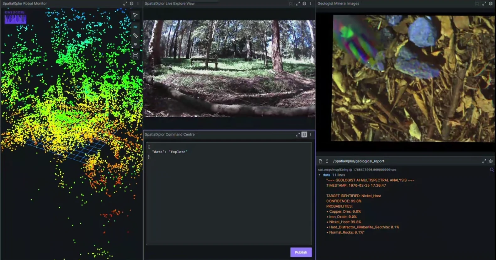
Real-time field intelligence

LiDAR, live video, multispectral observation and AI analysis.

03
SPATIALXPLOR CLOUD

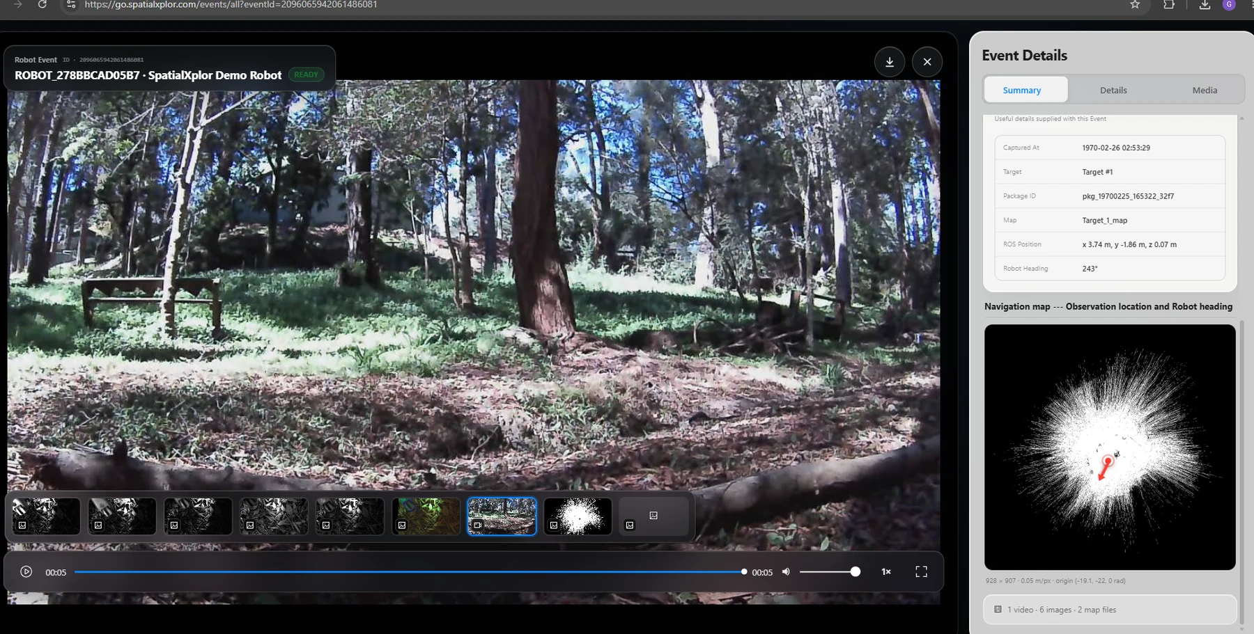
Mapped evidence and AI reports

Survey events, imagery, mapped observations and reports.

See prototype demonstration

EXECUTION CAPABILITY

Built by people experienced in turning complex technology into production systems.

Technology leadership. The team brings more than two decades of experience across enterprise software, AI, cybersecurity, cloud infrastructure and production systems.

AI research. The AI capability includes researchers experienced in deep learning, multimodal learning, transformers and complex scientific datasets.

Production engineering. The broader engineering capability has delivered secure commercial platforms across healthcare, media and advertising.

PARTNERSHIPS & PILOTS

Where could autonomous field intelligence create measurable value?

SpatialXplor is seeking domain partners and field-validation opportunities across resources, infrastructure, agriculture and environmental monitoring.

Discuss a Field Validation Pilot

contact@spatialxplor.com